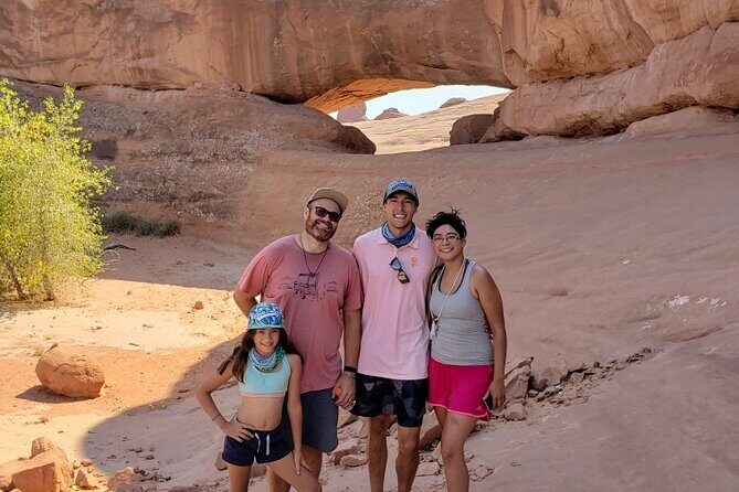
REVIEW · MOAB
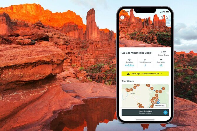
La Sal Mountain Loop Self-Guided Audio Tour
Book on Viator →Operated by Shaka Guide Apps · Bookable on Viator
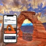
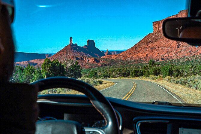
A car tour in Moab, no stress. This self-guided La Sal Mountain Loop drive gives you GPS directions plus audio stories, so you can explore the La Sal Mountains and nearby red-rock icons at your own pace. It’s built for the road—hands-free narration, turn-by-turn guidance, and offline maps so you’re not hunting for signal.
I like the offline GPS audio setup most. You can download once on good Wi‑Fi, then drive without data or Wi‑Fi, with the audio playing automatically as you approach each stop. I also like the value: it’s $15.99 per group (up to 15), and you get lifetime access to the app and data.
One thing to consider: if the La Sal Mountain Loop road is closed or a GPS signal gets weird in spotty areas, you may not be able to complete the full route as planned. Plan for a little flexibility—and download ahead like you mean it.
In This Review
- Key highlights worth your attention
- La Sal Mountain Loop audio tour: why this route feels easier than a checklist
- Price and time: what you really get for $15.99 per group
- How the offline GPS audio works (and how to avoid the common pitfalls)
- The 4–6 hour route: stop-by-stop what you’ll see and where to use your time
- Stop 1: Ken’s Lake—short walk, big mountain backdrop
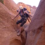
- Stop 2: Brumley Arch—steep work for a payoff of waterfall + rock form
- Stop 3: Oowah Lake—high alpine calm at 8,800 feet
- Stop 4: Warner Lake + the connection trail—serenity with an optional hike
- Stop 5: Castle Valley—panoramic view over the Colorado Plateau
- Stop 6: Bull Canyon Overlook + dinosaur track site—no long hike needed
- Stop 7: Castleton Tower—sandstone towers up to 1,400 feet
- Stop 8: Parriott Mesa—big summit presence, challenging hike option
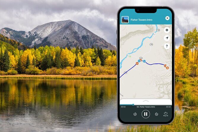
- Stop 9: Fisher Towers—towers, hoodoos, ravines, and movie-set vibes
- Stop 10: Moab Giants—free museum stop at Red Cliffs Lodge
- Stop 11: Salt Wash—river access and the kayaking idea
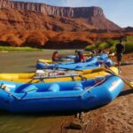
- Stop 12: Takeout Beach—where rafting and kayaking often end
- Stop 13: Courthouse Wash pictograph—Fremont people art with a short walk
- Road-closure reality check: how to keep your day on track
- Who this tour fits best (and who might want a different plan)
- Should you book the La Sal Mountain Loop self-guided audio tour?
Key highlights worth your attention
- Offline map + GPS: no roaming charges, and navigation works without Wi‑Fi or data
- Hands-free audio: narration and music play automatically while you drive
- Flexible timing: a 4–6 hour window, with time built in for hikes and overlooks
- Big variety for the cost: lakes, steep arches, dinosaur tracks, towers, and free museum stops
- Serious stop choices: keep it mellow or swap in more challenging hikes like Parriott Mesa
- One purchase per vehicle: pay per group, not per person
La Sal Mountain Loop audio tour: why this route feels easier than a checklist
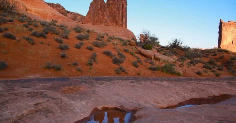
The La Sal Mountain Loop is one of those Moab-area drives that feels like it should be “planned.” You’ve got high-elevation lakes, geology that looks almost movie-made, and a string of viewpoints that reward slow driving.
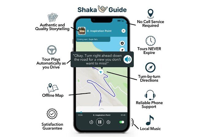
This self-guided audio tour turns that pressure down. You’re not stuck with a fixed group pace or a guide herding you from pullout to pullout. Instead, the app gives you GPS turn-by-turn directions and then starts the audio narration automatically as you approach each stop. That means you can focus on the road, pull over when you want, and spend your time where you actually want it.
And because it’s designed for offline use, you’re not stuck doing the classic “turn around and hope the map loads” routine. If you’re traveling in a part of the desert where cell service can be spotty, that alone is a quality-of-life win.
Other self-guided audio tours we've reviewed in Moab

Price and time: what you really get for $15.99 per group
At $15.99 per group (up to 15 people), this is priced more like a “bring-your-own-adventure” tool than an expensive guided excursion. If you’re in a couple, it’s still a fair deal for a full half-day of routing and narration. If you’re traveling with family or friends in one vehicle, the value gets even better because it’s not per person.
The typical time window is 4 to 6 hours, which is long enough to enjoy a real mix of viewpoints and short hikes without turning your day into a marathon. You can also skip stops if you want a shorter drive. That flexibility matters in Moab, where plans often shift with heat, crowds, and road conditions.
How the offline GPS audio works (and how to avoid the common pitfalls)
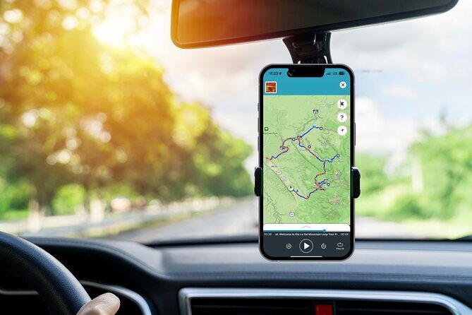
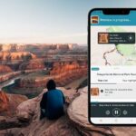
Here’s the basic setup, plain and practical:
- You book, then get an email with instructions and a redeem code
- You download the tour using strong Wi‑Fi (do this part well)
- In the Shaka Guide app, you select the tour from My Stuff and follow the GPS prompts
- As you drive, audio plays automatically, with turn-by-turn navigation using GPS
The big benefit is the offline piece: the map and GPS work completely offline, with no Wi‑Fi or data needed during the drive. That’s huge for road trips.
My practical tip: before you leave the parking lot, verify the app is fully downloaded and the audio is ready. If your phone battery is low, plug in. You want the experience to be about scenery and stories—not troubleshooting your screen mid-drive.
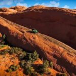
The 4–6 hour route: stop-by-stop what you’ll see and where to use your time
You’ll start on US-191 (North Highway 191N Hwy 191), Moab, UT, and the route ends back at the same place. Expect about 20 minutes per stop on average, but real time stretches when you hike or when you park for photos.
Below is the stop-by-stop reality check, including what each place is really good for.
Stop 1: Ken’s Lake—short walk, big mountain backdrop
Ken’s Lake is a popular campsite with the La Sal Mountains rising behind the water. If you’re looking for an easy win, this is it. From the lake, you can hike a short distance to a small waterfall.
Best use of time: park, take photos, and do the short waterfall walk if your legs are up for it. This is a good “warm-up” stop before you start stacking more strenuous hikes.
Other guided tours in Moab


Stop 2: Brumley Arch—steep work for a payoff of waterfall + rock form
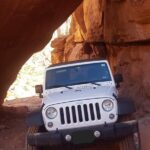
Brumley Arch is only about two miles round trip, but it’s described as steep and strenuous. You’ll also need to drive on an optional gravel road to reach the trailhead.
What you’ll get: at the end, a waterfall and the Brumley Arch rock formation.
Practical advice: treat this as a real hike, not a stroll. Wear shoes with grip, go steady on the climb, and expect that gravel-road access may not be ideal if you have a low-clearance vehicle.
Stop 3: Oowah Lake—high alpine calm at 8,800 feet
Oowah Lake sits at about 8,800 feet (2,600 meters). It’s popular for rainbow trout fishing, and it often mirrors the surrounding La Sal Mountains in a way that feels like a postcard.
Best use of time: enjoy the quiet and take in the mountain reflections. This stop is more about atmosphere than big hiking plans.
Stop 4: Warner Lake + the connection trail—serenity with an optional hike
Warner Lake is slightly smaller than Oowah, and it’s also known for rainbow trout fishing. On most days it’s pretty serene, though you might see more people during holidays or summer weekends.
The main activity here is a popular hike connecting the two lake areas: a 1.6-mile round trip trail.
How I’d plan it: if you want movement without “big hike fatigue,” this is a smart choice. It also lets you experience both lakes in one go without bouncing between stops too much.
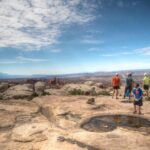
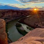
Stop 5: Castle Valley—panoramic view over the Colorado Plateau
This stop is basically a viewpoint daydream. You get sweeping panoramas of the Colorado Plateau below LaSalle, with sightlines that can include the Porcupine Rim, Castle Valley, Arches National Park, and Canyonlands National Park.
Best use of time: keep your windows open for the quiet, then take your photos before the sun shifts. Views like this reward patience more than speed.
Stop 6: Bull Canyon Overlook + dinosaur track site—no long hike needed
This is famous for dinosaur tracks left in the ground about 200 million years ago during the Jurassic period. The good news: no hiking is needed.
The detour does take time though—plan around 30 to 40 minutes for this stop.
Practical advice: even without a hike, bring a little time-buffer. Let yourself read the area, take photos, and slow down. Dinosaur-track sites can feel best when you’re not rushing.
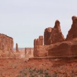
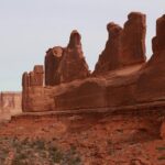
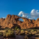
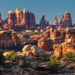
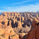
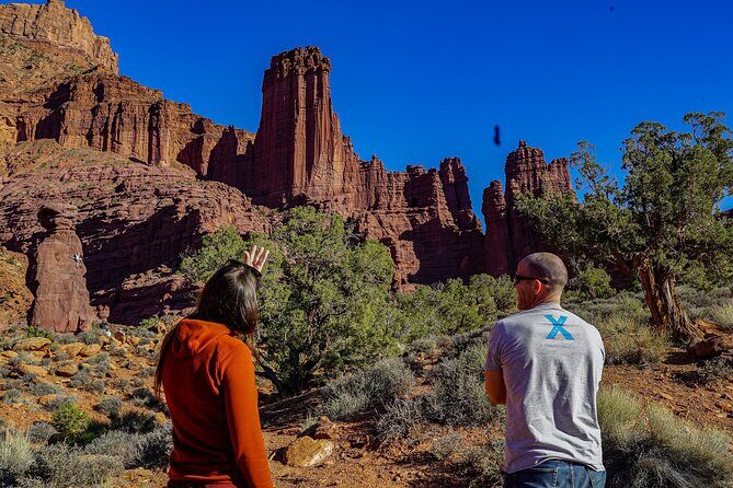
Stop 7: Castleton Tower—sandstone towers up to 1,400 feet
Castleton Tower is part of a cluster of sandstone towers with names like Castleton Tower, the Rectory, and Sister Superior. These structures rise as high as about 1,400 feet.
Best use of time: photograph the towers from the pullout and enjoy the height. This is one of those stops where the “wide angle” and “walk a few steps” approach works.
Stop 8: Parriott Mesa—big summit presence, challenging hike option
Parriott Mesa stands over 6,000 feet (1,800 meters) and looms over Castle Valley like a guard. It’s long—more than 1.5 miles—and wide—about a third of a mile. This is another magnet for climbers.
There’s a three-mile round-trip hike to the summit, and it’s described as challenging with a need for careful preparation.
How to decide: if you want a low-key drive, you can skip the summit hike. If you’re fit and prepared, this stop can turn the tour into a workout with dramatic views at the top—without being a full-day endurance mission.
Stop 9: Fisher Towers—towers, hoodoos, ravines, and movie-set vibes
Fisher Towers is known for a popular hiking trail with sandstone formations: towers, spires, hoodoos, ravines, and terraces. One fun angle is that Fisher Towers has shown up in films and commercials, so you may recognize it even if you’ve never hiked here before.
Best use of time: do the hike you feel like doing. If you only have energy for a shorter portion, still get out and walk—these formations reward even modest wandering.
Stop 10: Moab Giants—free museum stop at Red Cliffs Lodge
Moab Giants is a museum housed as part of the Red Cliffs Lodge. It’s connected to the film scene in the area, with mentions of productions like Wagon Master, Rio Grande, Taza Son of Cochise, City Slickers, Thelma & Louise, and more.
The standout practical point: there’s no charge to go in.
Best use of time: this is a great “reset” stop if the sun is strong or if you want a break from driving and hiking.
Stop 11: Salt Wash—river access and the kayaking idea
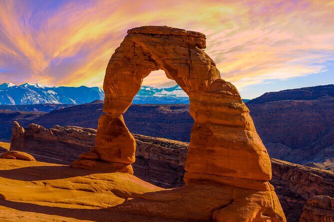
Salt Wash is where the Salt Wash River joins the Colorado River. If you have a kayak, you can follow Salt Wash upstream and possibly pop out near Delicate Arch inside Arches National Park.
Even if you’re not kayaking, this stop gives context for how the river system shapes Moab travel.
Time plan: use it for photos and imagining the water route. If you’re checking out the river vibe, bring water shoes if you plan to get close (the data here doesn’t specify, so keep it cautious).
Stop 12: Takeout Beach—where rafting and kayaking often end
Takeout Beach is where most kayaking and rafting trips end along the 13-mile Moab daily section of the Colorado River.
Best use of time: if you’re curious about water recreation, this is a clear “this is where the action finishes” point on the drive.
Stop 13: Courthouse Wash pictograph—Fremont people art with a short walk
Courthouse Wash has a pictograph created by the Fremont people about 2,000 years ago. There’s a short hike of about 500 feet from the parking area.
Practical advice: wear shoes you can trust on uneven ground. This stop rewards calm attention more than speed.
Road-closure reality check: how to keep your day on track
Self-guided is freedom—until a road is closed. The La Sal Mountain Loop is a drive you’ll want to check for current access before you commit your half day. If access is restricted, you may end up unable to reach later stops.
Also, because this is GPS-based audio, keep your phone secured (but not blocking your view), and don’t plan to do deep navigation while driving. Pull over, start your stop time, and let the audio play from there.
One more practical thought: if you know you’ll be in areas where signal can be weak, the offline download step matters. Do it with good Wi‑Fi the night before or at a reliable spot, and you’ll reduce the chances of audio or map trouble on the road.
Who this tour fits best (and who might want a different plan)
This is a strong match if you want:
- Autonomy: you like setting your own pace and skipping what doesn’t fit
- Easy direction finding: GPS turn-by-turn plus audio that plays as you drive
- A blend of sights: lakes, overlooks, geology stops, and a free museum break
- A group-friendly price: one purchase per vehicle, not per person
It’s especially useful for groups that want structure without being tied to someone else’s schedule.
You might choose something else if you hate steep hikes or you’re traveling with mobility limits that make stairs and uneven terrain harder—because some stops include steep terrain and short but real walks (like the Brumley Arch approach and the Courthouse Wash 500-foot hike).
Should you book the La Sal Mountain Loop self-guided audio tour?
If you want Moab scenery with built-in guidance and you care about getting the most out of a half day, I think this is a smart buy. The offline GPS audio is the key advantage, and the one price per group model makes it easy to justify, even with a full car.
Book it if you’re the type who likes choosing your own pace: do the easy lakes, swap in the tougher hike only if you feel good, and use the free Moab Giants stop as a quick break.
Skip it (or plan a backup) if you’re counting on completing every stop no matter what, because closures can happen and the route is road-dependent. If you’re flexible and ready to adjust, you’ll get a lot from this drive.